
Walk a Sammamish Street Record
Begin with geography, not a person. King County's Parcel Viewer accepts an address, parcel number, or condominium name. It returns the parcel and site address, then links the map to tax and district details. That first match gives the street directory a stable key even when a postal label, mailing address, or owner name has changed.
- Enter the full address in Parcel Viewer and confirm the jurisdiction, site address, and parcel number.
- Open the linked assessor report. Record the taxpayer role, mailing address, legal description, and date checked.
- Search the first ten digits of the parcel in Landmark. Switch to a legal or name search when the parcel trail stops.
- Choose Sammamish in MyBuildingPermit and search the site by number, street, or parcel.
- Use voter information only through its lawful, identity-assisted route. Never turn a bounded address search into a private roster.
This sequence separates current tax data from recorded transfers and city activity. It also prevents a common error: calling a taxpayer, deed party, or permit applicant the present occupant. A reliable by-address note says what each source proves and when it was checked.
Sammamish Parcel Search Fields
The King County Assessor eReal Property site is parcel-oriented. A user normally reaches it after resolving an address in the county map. The assessor can also help by phone at 206-296-7300 or at a public counter when the web result is unclear.
| Search or field | Input | How it helps | Limit |
|---|---|---|---|
| Property tax account | Account identifier | Opens the tax record | Not an occupant search |
| Parcel number | 10-digit parcel | Links map, tax, and deed work | Old records may use another key |
| Situs address | Shown in report | Identifies the physical site | May differ from mailing address |
| Legal description | Subdivision, lot, block, or survey terms | Survives address changes | Read with the source record |
| Taxpayer name | Shown in report | Supplies a deed-search lead | Does not prove residency |
The assessor page warns that its data can change and cites the Washington restriction on lists of individuals for commercial purposes. Parcel-specific, personal research is the sound use. The street directory should preserve the site address and legal description separately from the taxpayer mailing field.
The official interface shows the account and parcel entry point. Open the live eReal Property search before relying on the captured view.
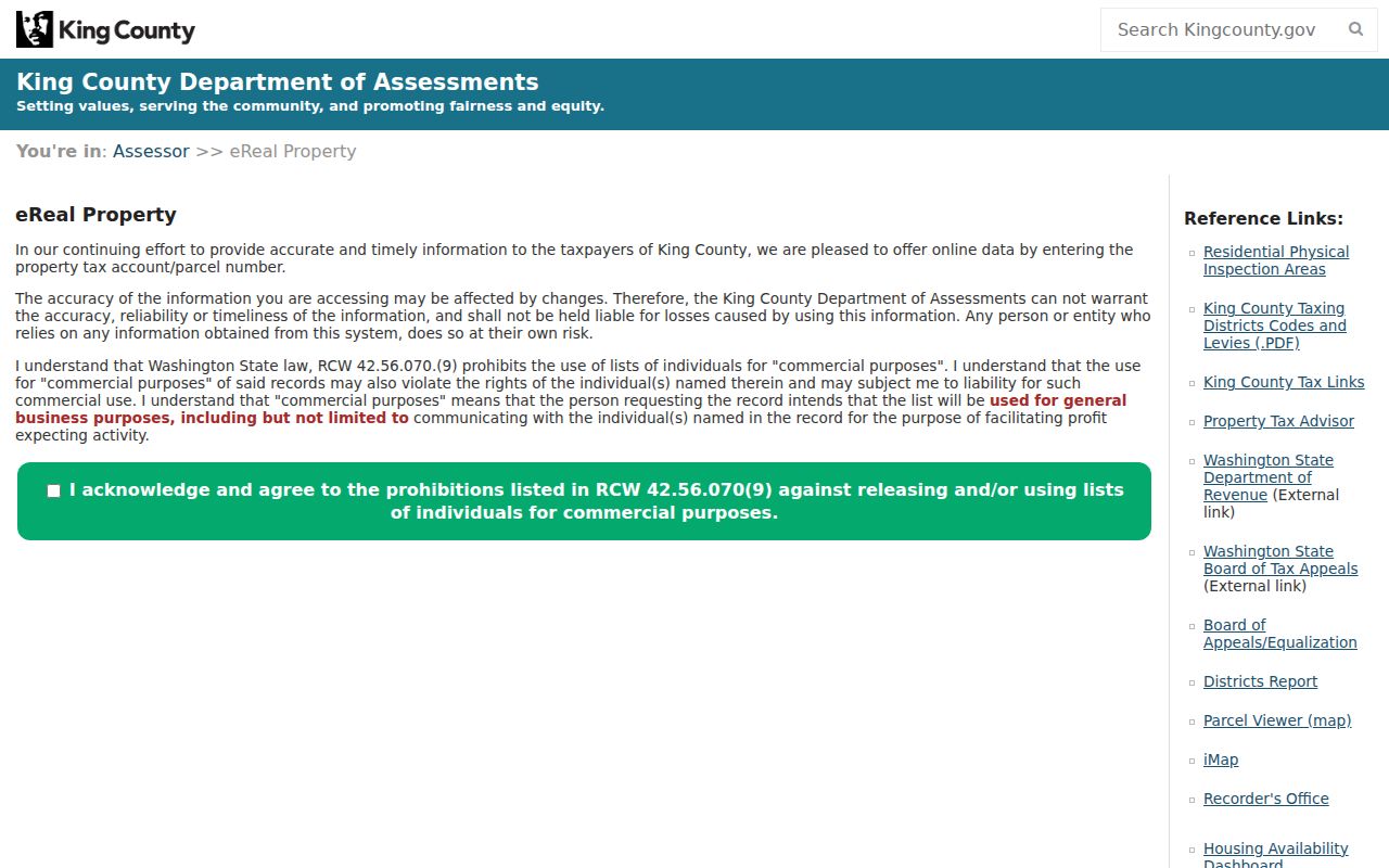
The screen confirms why a parcel number is the practical bridge from an address to a property report.
Sammamish Records Kept By Address
No official office publishes a complete resident list for a Sammamish road. Several address-keyed systems can still answer narrower questions about ownership, parcel shape, recorded interests, or work approved at a site. Their different roles make a street-by-street comparison useful.
| Address record | Official keeper | What appears | Access path |
|---|---|---|---|
| Tax property report | King County Assessor | Taxpayer, situs, mailing, legal, use, value | Free web search, phone, counter |
| Parcel map | King County GIS Center | Parcel, address, jurisdiction, layers, nearby lots | Parcel Viewer or iMap |
| Recorded documents | King County Recorder | Parties, dates, types, parcel or legal terms | Landmark, mail, phone, counter, Archives |
| Permits | City of Sammamish | Project, applicant, status, activity, site | MyBuildingPermit or records request |
| Voter material | King County Elections | Identity-assisted registration and election geography | Individual lookup or lawful file request |
The parcel number links the strongest sources, while the street name helps with permits and historic files. A deed party may have sold years ago. A permit applicant may be a contractor. Voter records have statutory use limits under RCW 29A.08.720, and the individual lookup requires three of four identity fields rather than a free street browse.
Note: Date every result because tax, permit, election, and boundary records update on different schedules and describe different roles.
Browse Sammamish Parcels By Street
Parcel Viewer adds the spatial part that a text list lacks. Search an address, inspect the parcel popup, then click only the lots needed for the question. Address points, parcel labels, zoning, political boundaries, natural-resource layers, and aerial or topographic views can explain why two homes with similar mailing labels are in different jurisdictions.
The selection, buffer, measure, intersection, and export tools support a small, repeatable set. County lot lines are approximate and are not survey evidence. A parcel that merely falls in a circle is not necessarily touching the subject lot, and a road or common tract may separate two sites.
Compare the current Parcel Viewer controls with this captured Sammamish street directory view.
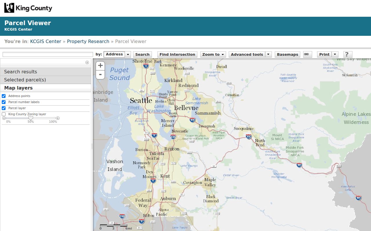
The mapped context keeps a mailing label from being mistaken for a city boundary or legal lot line.
Sammamish Streets In Landmark Records
The King County Landmark index covers recorded documents from 1976 forward. Its modes include name, document type, book and page, consideration, recording number, parcel ID, record date, legal, advanced legal, quick, Torrens, and plat reservation. Parcel search uses the first ten digits and covers 1997 to the present.
For a current parcel, examine deeds, easements, covenants, plats, and boundary adjustments linked to it. When the parcel search ends before 1997, use parties from the oldest found instrument as name-search leads. Legal and advanced legal fields accept subdivision, lot, block, section, township, range, plat book, quarter, and text modes. Those terms can remain stable when a street address does not.
Review Landmark's official search choices before selecting a mode.
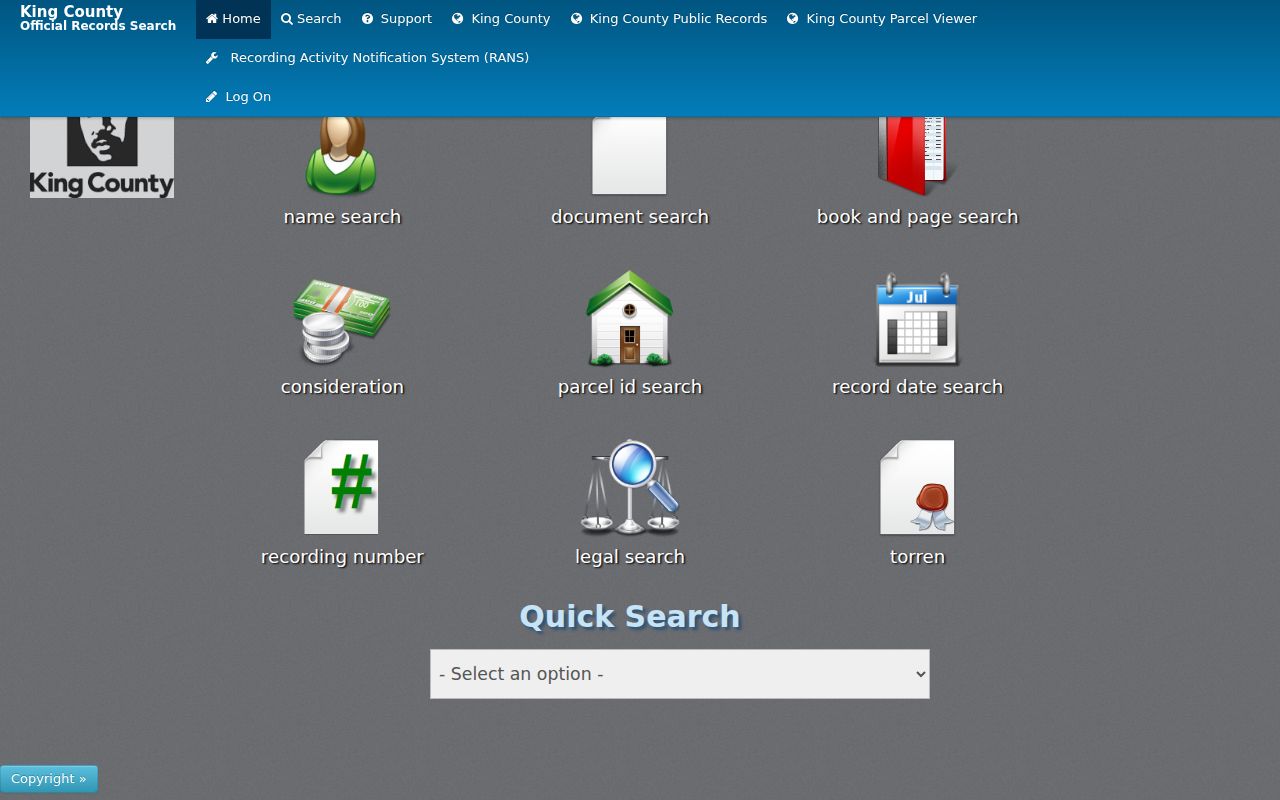
The choice of parcel, name, or legal search determines whether an older address trail continues or appears to end.
Sammamish Street Record Terms
Address systems use a few terms with precise meanings. Keeping them distinct prevents an owner name or map line from being overstated.
- Parcel
- A county tax and map unit identified by a parcel number. It may not match one household or one mailing address.
- Situs address
- The physical site address in a property record, distinct from the taxpayer's mailing address.
- Plat
- A recorded map defining lots, blocks, roads, easements, or common tracts within a subdivision.
- Criss-cross directory
- A directory arranged by street or phone number instead of only by surname. No verified Sammamish-specific run was found in the official sources reviewed.
Use the label printed by the custodian. A taxpayer is not automatically an owner in every legal sense, and neither term proves who occupied the address on the search date.
Sammamish Permits Along A Street
MyBuildingPermit searches Sammamish projects by permit number, project information, location, or people. Location fields include number, street name, and parcel. Type, status, and date filters reduce false matches. Results may show project status, inspections, conditions, fees, activities, and linked applications.
Pre-1999 permits may remain with King County because Sammamish incorporated that year. If the portal does not return the needed file, send a narrow request through the city public disclosure route. Name the address, parcel, date range, record category, and desired format. The city accepts online, email, mail, and in-person routes and gives an initial response within five business days.
Check the live permit portal fields against the captured search page.
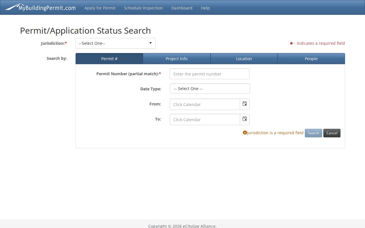
The jurisdiction and location controls keep the query tied to a dated municipal record, not an assumed household.
Old Labels On Sammamish Streets
Sammamish became a city on August 31, 1999. Earlier plateau records may sit under King County, Redmond, Issaquah, a school district, or a former community name. Inglewood, Monohon, Beaver Lake, Pine Lake, Lake Sammamish, and rural-route variants are useful companion terms for archives, directories, census material, and legal descriptions.
The Klahanie annexation took effect January 1, 2016. That date can explain why the same address appears with different jurisdiction labels in two official records. Search both the current street and historic place, but retain the original wording in notes. The King County annexation layer helps date the municipal label.
ZIP codes require the same care. The primary Sammamish postal areas are 98074 and 98075, while 98029 can appear in related files. A ZIP field does not by itself establish the city limit.
Older Sammamish Street Records
Landmark's index begins in 1976, but not every old image is online. Documents recorded before August 1991 may need the King County Archives recorded-document route. Archives may also hold short plats, easements, property cards, microfilm, and county records absent from a current city portal.
Online watermarked images are unofficial. Certified copies come from the Recorder's Office. Current researched charges were $3 for the first legal-size certified page plus $1 for each added page, and $1 per page for uncertified copies. Verify the fee before ordering. The office at 201 S Jackson St, Suite 204 in Seattle also accepts in-person, mail, phone, and online copy requests.
Online access is only one route. Call the Recorder at 206-477-6620 to confirm the custodian, cutoff, document number, fee, and counter plan. Mail requests go to 201 S Jackson St, Suite 204, Seattle, WA 98104. The weekday counter provides in-person access, while King County Archives handles older material that the live portal does not display. For assessor questions, call 206-296-7300 or use the public counter; the county directory also lists fax 206-296-5107. City permit records can be requested online, by email at PRR@Sammamish.us, by mail to City Hall, or in person. A written request should name the address, parcel, date range, existing record type, and desired format. These fallback channels matter when a portal has no result, an image is unavailable, or a certified copy is required.
Note: Call 206-477-6620 to confirm a document cutoff, current fee, counter hours, and the correct request channel before traveling.
Limits Of Sammamish Street Lookups
A street directory built from public records has firm limits. The assessor identifies a taxpayer and property facts, not every person at the site. Deeds identify recorded parties. Permits identify people or firms attached to a project. The voter lookup is identity-assisted, and a public voter-file request has restricted uses. Protected records and Washington's Address Confidentiality Program can properly stop the trail.
Commercial people-finder products may merge stale or unrelated data. Official indexes are narrower, but their field labels, dates, custodians, and request routes make each result easier to test. When the question becomes historical, use the Sammamish city directory collections route rather than treating a current taxpayer as a former occupant.
Lawful use. Use Sammamish address records for family history, property research, consumer safety, or civic questions. Never use them to stalk, harass, intimidate, or expose a protected address.